
To become a national leader in aviation data technology and geospatial intelligence, enhancing public safety, sustainability, and operational efficiency through innovative digital platforms.
Innovative Solutions Tailored for Safety, Surveillance, and Spatial Intelligence
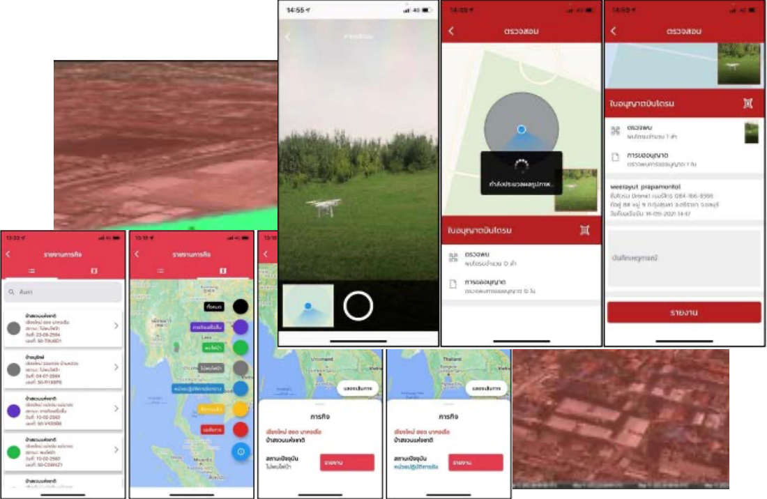
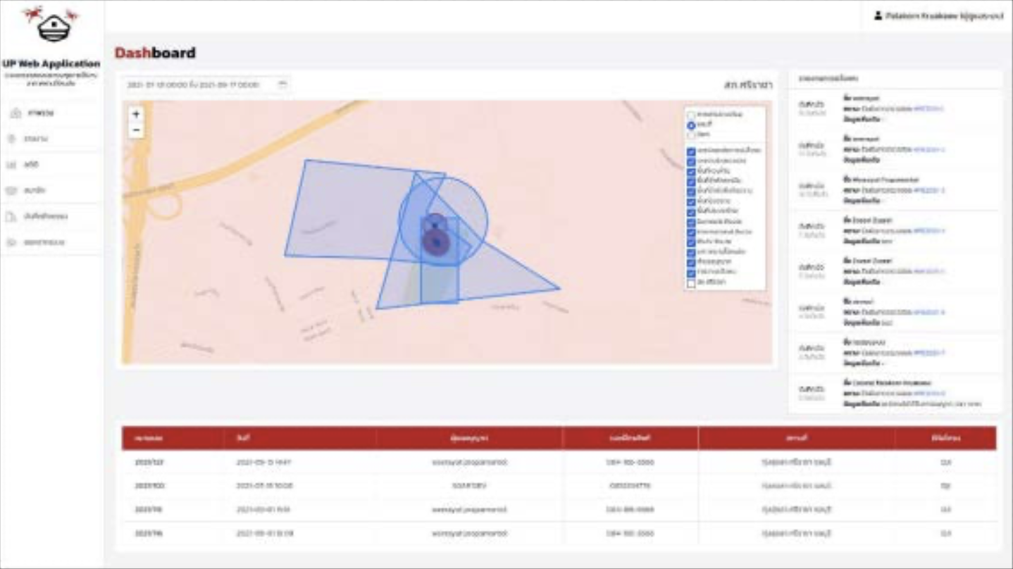
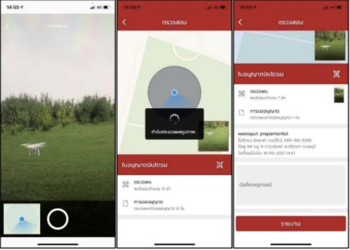
A system for law enforcement officers to monitor and analyze drone
flight permissions.
- Mobile App for field inspection with
image-based drone verification (Android & iOS)
- Web Application for tracking UAV flight zones,
connected to the USOAR (drone flight permit database)
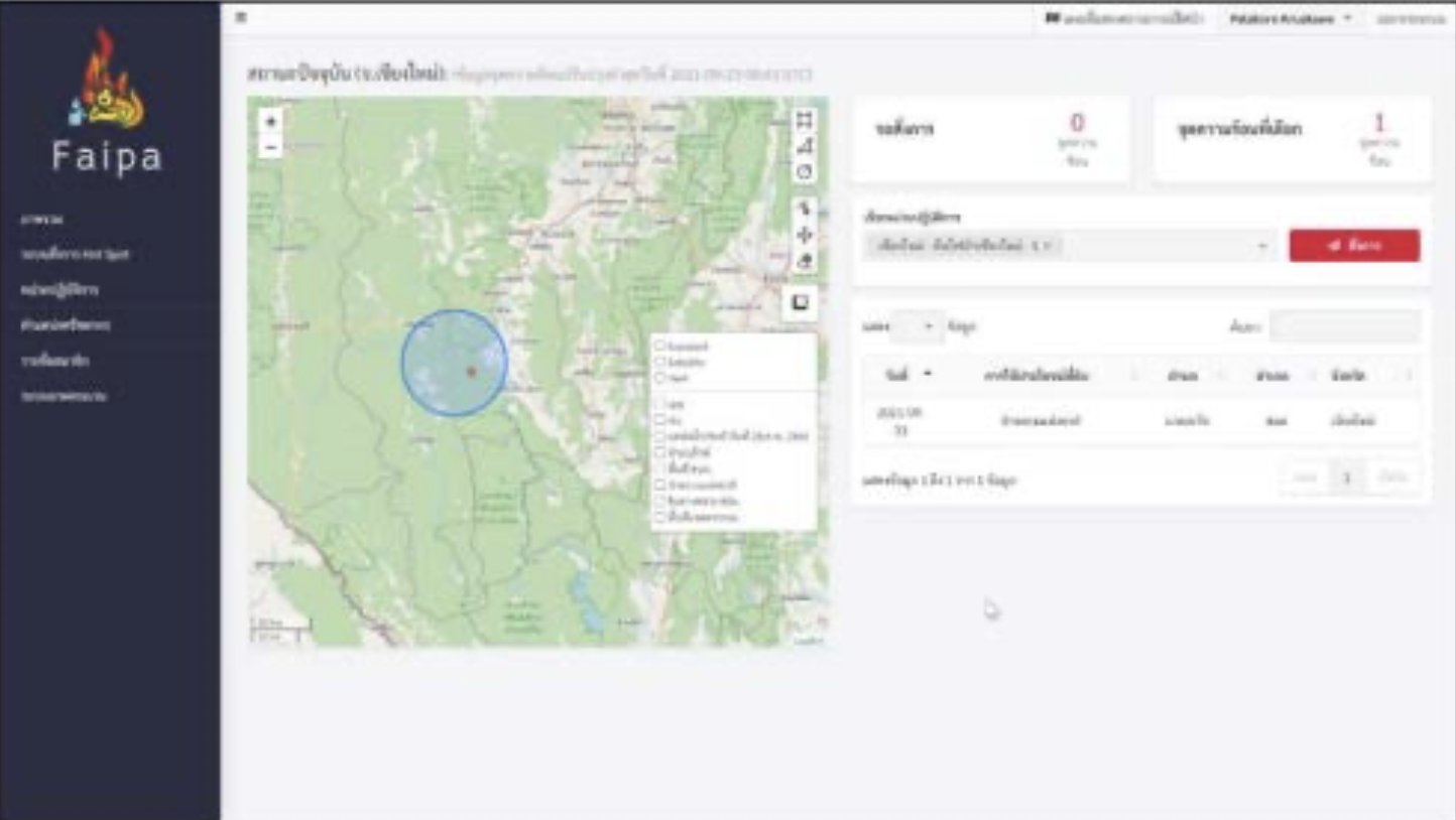
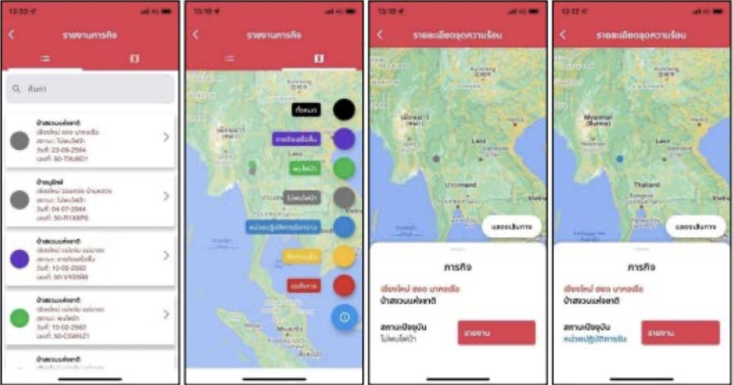
A real-time geo-informatics system integrating satellite data from
Terra, Aqua, and Suomi NPP.
- Web Application for analyzing and visualizing
hotspots
- Mobile App for frontline wildfire responders to
receive orders and report situations
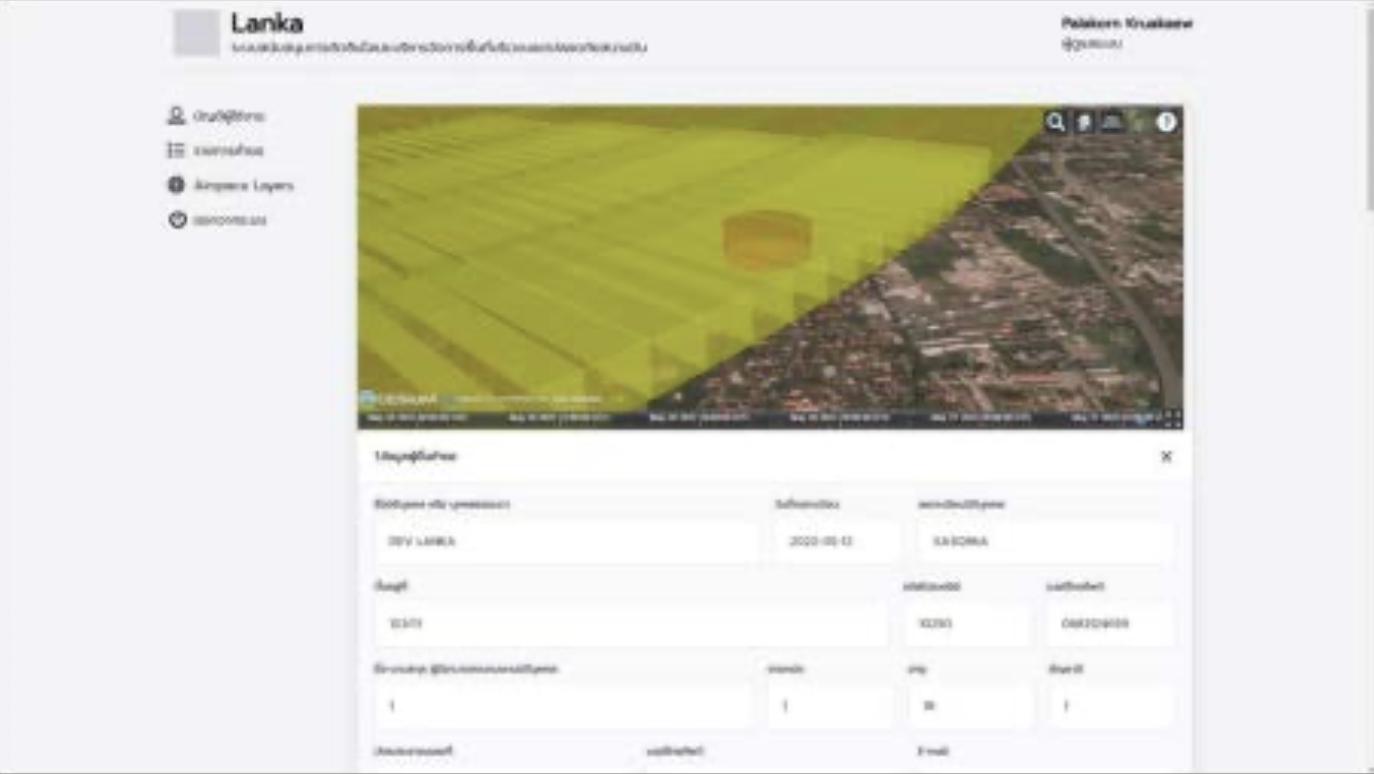
A robust solution for managing airport safety zones and
construction permissions.
- AIXM 5.1-compliant aviation data integration
- Web App for reviewing and approving building
requests
- Mobile App to evaluate permissible structure
height at specific locations
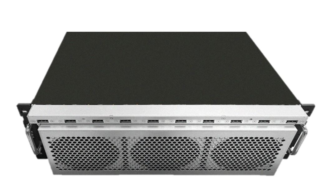
Built for the most demanding AI, big data, and cloud workloads, this enterprise server delivers exceptional processing power, high-speed memory, and expansive storage capabilities.
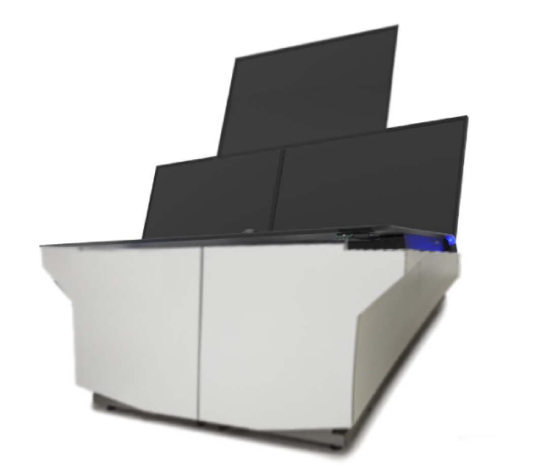
The Mobile War Room is designed to provide a fully integrated, high-performance command and control solution, enabling real-time decision-making and efficient operational management in the field.
Xprime Co., Ltd. is a Thai technology company
specializing in geo-informatics,
aerospace systems, and
custom IT solutions.
Established in 2018, we partner with government and private sector
organizations to deliver smart, data-driven platforms for
aviation safety,
environmental monitoring, and
decision support.
XPRIME COMPANY LIMITED
50 Sawātdikan 2 Road,
Nong Khaem Subdistrict, Nong Khaem District, Bangkok 10160,
Thailand
Email: contact@xprime.co